Hikes from San Miguel de Allende
By John Pint
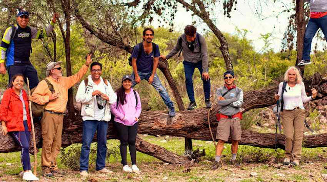
Travel + Leisure magazine calls San Miguel de Allende “Mexico’s hidden treasure” and everyone I’ve spoken to agrees it’s as close to Paradise as you’re likely to find on this little old planet. It is, however, “town,” and those Sanmiguelenses who occasionally get a hankering for “country” may appreciate the advice of local resident Randy Kremlacek who is one of the leaders of the San Miguel Hiking Group.
“The group has been doing this for at least 20 years,” Kremlacek told me. “In the beginning, hikers showed up at a local gas station at 8 a.m. on Sundays. I joined them because I thought it would be a good way to meet people, and to get to know el campo, the countryside. I had zero experience hiking.
“The first time I went with them, we were walking along and suddenly they started climbing up this mountainside… and I thought: it's perfectly flat to the left; why are we doing this? So, it took me a while to learn what hiking is all about.”
Below are descriptions of several hikes listed in the group’s Guide to Walks and Hikes near San Miguel. Download the Guide from their English-language website for links to maps, GPS tracks and contacts for local guides.
El Charco del Ingenio
(The Puddle near the Mill: named for a swimming hole near what are claimed to be the ruins of the first mill on the American continent, built in 1561).

“This,” Kremlacek told me, “is a botanical garden located in town, but somehow separate from town because it’s up high and you must cross pasture land to reach it. It's more of a walk than a hike to me, but it's a great place for people to get to know the flora and fauna of this area.”
"The botanical garden," says the unnamed author of an article on the Mexico Desconocido website, "covers 67 hectares and has one of the most complete collections of Mexican cacti and succulents in the world. Many of these have been rescued from little-known areas of Mexico's deserts and are often rare, threatened or in danger of extinction.”
This collection is thanks to cactophilist Charles Glass who settled in San Miguel in 1993 and then toured the country searching for plants to bring back to El Charco.
In 2004 the Dalai Lama visted the botanical garden and declared it a Peace Zone, a space free of violence and arms.
Parque Landeta
This is an ungroomed pastoral park, located adjacent to El Charco del Ingenio. “It makes for a nice loop around the wetlands in the rainy season,” says Kremacek. “In my opinion, it's more of a dog walk, but it offers a bit of a break from city life because it's completely wild. It's nothing spectacular like you’d find outside of town, but you will be getting peace and fresh air. And you almost feel like you are out in the campo (countryside).”
Tres Cruces (Three Crosses)

“This hike,”continues Kremlacek, “is also called the Suspension Bridge Hike. When you leave town and head south, there's a big hill topped by numerous antennas. You have a spectacular view of the city from up there, but if you proceed on to the suspension bridge and zipline area, you cross over that hill and now you have a view of the presa, the dam. and the Guanajuato mountains in the distance. At first it's pretty steep, so it's a moderate, not an easy hike, perhaps seven or eight kilometers. You’d never know that you are so close to town.”
La Joyita (The Little Jewel)

Kremlacek says this is a beautiful camping area located about 15 kilometers from San Miguel. The first 11 kilometers are paved, and the remaining four are what hikers would call “good road,” but what others might consider challenging. “There's a family that lives here,” he says, “which has worked with foreigners and has developed a campsite. It’s a great place to spend the night: quiet, little light pollution and there is no music. They have both rough camping and two or three cabins as well as old Airstream trailers. They also have a rustic, full kitchen. Here you have an absolutely stunning view.
“It's also the only place we hike where you have marked trails. This means you'll find arrows: red for one trail, blue for the other, nothing fancy. To hike, you just show up and go for it. For camping, it would be a good idea to call and make a reservation: 415 153 7092.
Presa Allende (Allende Dam)

The dam was built in 1967 to provide water for irrigation and is fed by the Laja River. A small community of indigenous Otomí was forced to relocate, their houses swallowed up by the artificial lake. Says Kremlacek: “One thing people go to see is the Capilla or Sunken Church. Depending on the water level, it's barely visible to totally accessible. Unfortunately, it's brown water, polluted by runoff from the agribusiness, and right now it's half covered with water hyacinth.
“You can walk to the ruins, but the starting hiker would need someone to lead him to this spot. If they are familiar with programs like Wikiloc or Alltrails, they can do it, but otherwise they're going to need someone to show them where it's at.
“By the way, the land around there is perfectly flat, so this walk is a stroll. The challenge here is that in the wet season, there's a lot of growth. But it's beautiful and there are lots of birds to see. The presa is just full of them and it's very green all year long.“
Río Laja (The Laja River)

The Rio Laja Trail is a walking and biking trail following the banks of the Rio Laja from the Presa Allende for a distance of 51.9 kilometers. The trail is based upon foot paths that have been established by rural residents over many years.
It’s a great place for getting exercise, enjoying the peace and beauty of nature and for viewing birds. It’s such a nice place, in fact, that the Audubon Society has published a Río Laja Trail Guide consisting of 12 printable PDF files with descriptions, waypoints and photos of each stretch of the route.
After a long day of hiking, you are bound to work up quite an appetite. Knowing that Randy Kremlacek is co-owner of Venencia Restaurant in San Miguel, I asked him what he would recommend to the hungry hiker.
“We are the authentic Oaxacan restaurant in San Miguel,” Kremlacek told me. “After a hard day of hiking, people might enjoy our tlayuda (also called clayuda).”
Here is Kremlacek’s description of tlayuda “for the ears of a foreigner:”
"Imagine the thinnest pizza crust possible, with only Mexican ingredients on top. So it's a paper-thin tortilla, griddled until it's brittle, covered with black bean paste and then a variety of toppings. It comes to your table in a big flat comal or griddle pan and you just snap pieces off. It's an ideal communal food. Four of you can eat out of the same dish.”
This may be the perfect way to end a day hiking outside the gates of Paradise.


Comments
Post a Comment